At 7:00 John dropped me off at the entrance of Coronial Knob
Walkway where I finished walking yesterday. Bought lunch at a bakery nearby. 2
x clubhouse sandwiches with lots of filling and 2 slices of cakes costed me
only $12.20 - wow, it's so cheap!! Bakery staff said they cannot get customers
if it was more expensive than this, because residents living in the area
were not very wealthy and there were many competitors. Sounded a tough business,
but good for consumers.
Walked up to Colonial Knob. Carpark was full in early morning. This mountain is
the highest of Wellington's (459m) and a popular spot among locals for daily
exercise and training. On the north of the mountain where the track starts,
there was a NZ native forest; and there was a farmland on the south.
On the
summit, there were an air control radar system and a mobile phone arial. On a
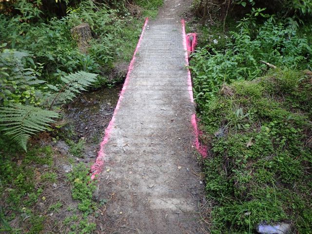
way down, the trail went into a planted pine forest and I saw a warning sign
that said "Danger - the bridge ahead could collapse". Hmm, how
dangerous would it be... Let's walk down to have a look. When getting there,
saw an ordinary wooden bridge over a small shallow stream - how disappointing.
Went up to Mt Kaukau following an old bridle path after 1hr walk on the road. It was a fine day with a gale, and windmills of a wind power station were
turning very fast in the west. From the summit 20m high TV tower rises, with
deep emotion I overlooked the scenery of the Wellington city, and Island Bay,
the goal of North Island Te Araroa walk - yes, I got here eventually... On the west, I could see
mountains of the South Island.
Down the mountain, and walked through the Wellington city
to the entrance of Mt Victoria that I will walk tomorrow, casting a sidelong
glance at the beach where people were sunbathing in togs. Walked back to
Wellington Station. Met with John in front of the Gandhi statue and went home. We will walk together the last 10km tomorrow. Walked 33km today.
朝7時。ジョンに昨日歩き終えた頃にアル・ノブ・ウォークウェイのスタート地点まで車で送ってもらう。その手前にあるパン屋で昼食を購入した。具がたっぷり詰まったクラブ・サンドイッチ2つとケーキ2切れを買ってNZ$12.20(約¥1,000)と安いので驚いた。店員の話だと、周辺はあまり豊かな地域ではなく、また競合するパン屋も多いので、大変だがこの値段でないと客が来てくれないとか。
それからコロニアル・ノブへと登り始めたが、早朝なのに駐車場はもう車で一杯。この山はウェリントン近郊の最高峰 (459m) で、地元の人にとっては日課のように登りに来る、トレーニングの場所としても親しまれているようだ。登山口のある山の北側にはNZ原生種の樹木の森が残り、南側は牧場に開拓されていた。また、頂上には航空管制用レーダーや携帯電話用のアンテナ等が立ち並んでいた。下山道は途中から松の植林となり「この先の橋は崩落の可能性があり危険」という警告板が。どんな危ないところかと逆に興味を覚えていってみると、浅い小川にかかった何てことのない木橋で拍子抜けした。
その後は1時間ほど車道を歩いて次のカウカウ山へ。昔の馬車道を登っていく。天気は良いが凄い強風の日で、西にある風力発電所の風車が勢い良く回っている。山頂には高さ120mのテレビ塔があり、眼下にはウェリントン市街地、そして北島TAのゴール地点、アイランド湾までもが見渡せ、ついにここまで来たかと感慨を覚えた。西の方には南島の山々も見えている。
下山後はウェリントン市街地を抜け、多くの人が水着で日光浴しているオリエンタル湾を横目に、明日登るビクトリア山の登山口まで歩いた後、ウェリント駅までとって返す。駅前のガンジーの銅像前でジョンと待合せ一緒に帰宅。明日は最後の10kmを彼と二人で歩く予定。本日の歩行33km。


No comments:
Post a Comment